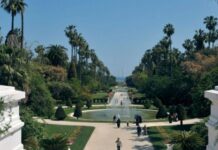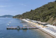
Edirne sits at the crossroads of continents. It is the bridge between Turkey and Europe. Located in the Trakya region of the Marmara Province, this city feels less like a border town and more like a living museum. With a population of just under 166,000 and a land area of 844 square kilometers, it is spacious. It is not crowded. It is quiet.
The name tells a story. It started as Hadrianoupolis. That was the city built by Emperor Hadrian. Over time, it became Edrenebol in Ottoman Turkish. Then Edrene. Finally, it settled on Edirne. The locals know it simply by that last name.
The Water and The War
Geography dictates life here. Edirne is built where three rivers meet: the Meriç, the Tunca, and the Arda. The water defines the landscape. The climate is continental. Summers are hot. Winters are cold.
The history is heavy. The first settlers were the Odrysian and Bettegerian Thracian tribes. Centuries later, the Ottoman Empire left its mark. You can see it in the architecture. You can taste it in the food. The city is a guardian of Ottoman palace cuisine. If you want to know what Turkish royal food tasted like, come here.
Edirne joined Turkish soil after the Second Balkan War. It is a city that has seen empires rise and fall. Today, it is a peaceful hub for tourism.
What To See First
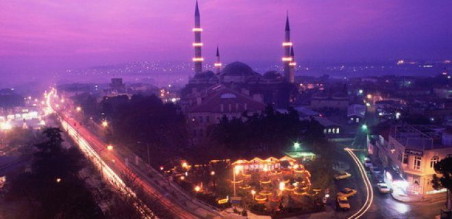
You cannot visit Edirne for history and leave hungry. You cannot leave without seeing the Great Selimiye Mosque. It was built by Mimar Sinan. It is widely considered his masterpiece. The dome soars above you. The light filters in through stained glass. It is peaceful.
But there is more. The city has eight districts. You should know their names if you plan to explore. They are Enez, Havsa, İpsala, Keşan, Lalapaşa, Meriç, Süloğlu, and Uzunköprü. Each has its own character. Some are near the Greek border. Some are inland.
Start with the city center. The historic district is walkable. You will pass old caravanserais. You will see the Ulu Camii. The architecture is Ottoman. It is grand. It is detailed. Do not rush.
The Wrestling Festival
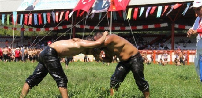
There is only one event that matters in May and June. The Kırkpınar Yağlı Güreşleri. This is not a sport. It is a tradition. It has been happening since 1357. That is nearly 700 years.
Oil-covered wrestlers compete in a sand arena. The strongmen wear leather trousers called kıspet. They try to throw each other. The winner becomes the Başpehlivan. This title is prestigious. It is the highest honor in Turkish wrestling.
Why does this matter to you? It is the heart of Edirne tourism. The festival draws crowds from all over. It is a spectacle. You can watch the qualifiers. You can see the finals. It is loud. It is energetic. It is unlike any other festival in

The High Road: Altitude and Ascent
The bus ride from La Paz to Uyuni is not a scenic detour; it is a test of stamina. You are climbing out of the tropics and into the thin, biting air of the Altiplano. The landscape shifts from dense cloud forest to a stark, moon-like desert in under four hours. Most tours leave La Paz at 5 a.m. You will wake up before the sun. Bring layers. The temperature swings from freezing night air to blinding midday heat, and the bus windows seal you in a cycle of condensation and cold.
The stop at the Laguna Colorada is where the surrealism begins. It sits at 4,300 meters. The water is a deep, rusty red due to iron oxide and algae. It looks like blood on a plate. You are looking for Andean flamingos. They stand knee-deep in the toxic-looking water, pink against orange, white against brown. They are shy. If you move too fast, they vanish into the mud. The best light is early morning, before the wind picks up and chills your bones.
Salt Flats: Whiteout and Reflection
By the time you hit the Uyuni Salt Flats, the world has lost its edges. The horizon disappears. The sky and the ground merge into a single, blinding white expanse. This is not a place for casual strolling. It is a place for orientation. Without landmarks, you can walk in a straight line for kilometers and end up exactly where you started.
The heat here is deceptive. The salt reflects sunlight like a mirror. You need sunglasses. All day. Every day. The glare can cause snow blindness if your eyes aren’t protected. Most tours include a stop at the Incahuasi Island, a rocky outcrop rising from the salt. It’s touristy, crowded with buses. Skip the souvenir shops. Instead, climb the tallest cactus you can find. The view stretches for miles. You can see the curvature of the earth if the air is clear.
Rain changes everything. When it rains, the salt dissolves into a shallow layer of water. The sky reflects perfectly. The “mirror effect” is the reason people fly here. It creates an illusion of walking in the sky. But you can’t time it. It happens once or twice a year. If you don’t catch it, you see dust. Just dust and heat.
Train Cemetery and Geometric Oddity
Off the main circuit lies the Train Cemetery. Abandoned locomotives from the 19th century rust in the salt. They look like skeletons of beasts. The air smells of iron and dry earth. It is quiet here. No tours stop long. You walk among the metal giants, imagining the steam engines that once carried tin and silver. It is a stark reminder of Bolivia’s resource history. The trains didn’t leave because they broke. They left because the economy collapsed.
Further north, the geysers of Sol de Mañana wake up the morning. Steam vents hiss from the ground. The ground itself is yellow and orange from sulfur deposits. The water is boiling hot. You cannot swim in it. You can only look. The steam rises into the cold air, creating clouds that hug the valley. It feels like standing on a living volcano. The altitude presses on your chest. Breat