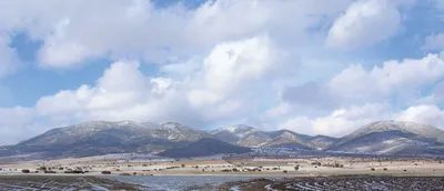
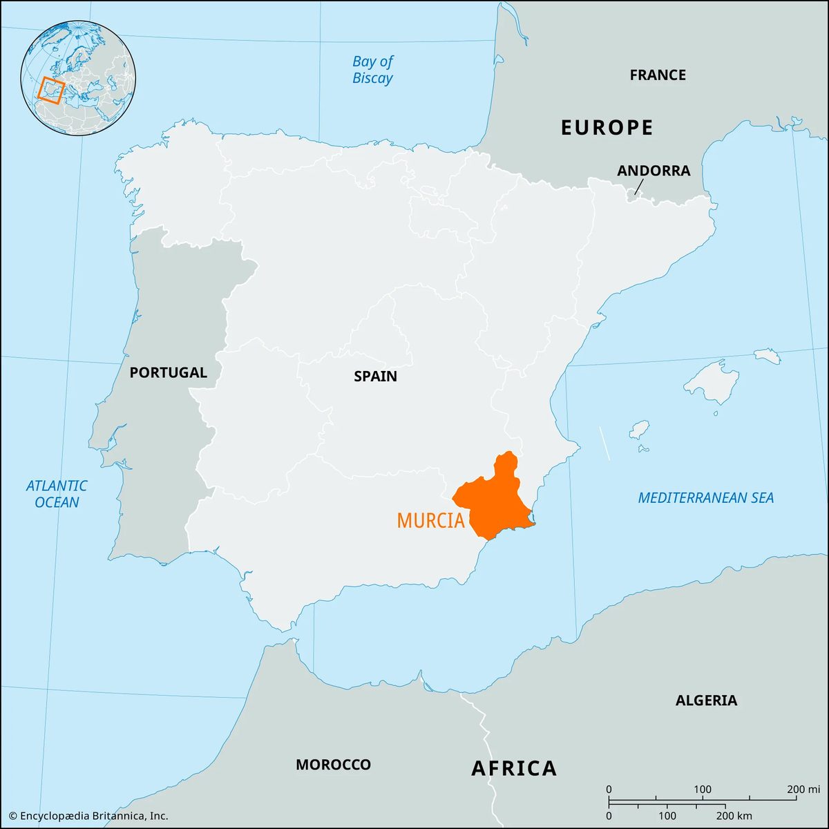
You are standing on a ridge in southeastern Spain, looking down at fields that seem to go on forever. This is Murcia, a place that exists entirely between the Mediterranean Sea to the south, Castile-La Mancha to the north, Andalusia to the west, and Valencia to the east. It is an autonomous community established in June 1982, sharing its borders exactly with the province of Murcia.
Most travelers skip it. They want the beaches of Valencia or the flamenco of Andalusia. Murcia offers something different. It is arid, intense, and historically layered. With a population of roughly 1.4 million people spread across 4,368 square miles, the region feels spacious without being empty. The capital, Murcia city, anchors the experience, but the geography dictates the mood here.
Where Murcia Fits in Southeastern Spain
Location matters. You are not in the center. You are in the corner. The region is bounded by three other major regions, which creates a crossroads effect.
- North: Castile-La Mancha brings in the dry, vast landscapes.
- East: Valencia offers a gateway to coastal tourism.
- West: Andalusia adds weight and history.
- South: The Mediterranean Sea provides the coastline.
This positioning makes Murcia a transition zone. You get the continental dryness of the interior mixed with the maritime influence of the coast. If you are planning a route through southeastern Spain, Murcia is the bridge. You do not have to choose between the inland and the sea. You take both.
The Practical Basics: Size and Population
The numbers are concrete. The area is 11,313 square kilometers. That is a significant footprint. It is not a tiny enclave. It is a full region with its own identity.
The population estimate from 2007 places the resident count at 1,392,117. For a digital traveler, this means you are entering a region that supports a steady flow of services, transport, and cultural infrastructure, but it is not a megacity. The density allows for exploration without the crushing crowds you find in Madrid or Barcelona.
Why does this matter? Because you can move quickly. The distances between points of interest are manageable. You are not driving for hours just to see a single monument. The region is compact enough for a weekend, yet varied enough for a week.
What to Expect From the Landscape
The geography is the first thing you will notice. It is not lush. It is not green in the way the northern valleys are. It is defined by light, heat, and open space.
The southern edge meets the sea. That is your entry point for coastal activity. But as you move north, the terrain changes. The influence of Castile-La Mancha pushes the landscape toward the arid and expansive. You will see plains that stretch until they blur into the horizon. This is not a place for misty mornings. It is a place for sharp light.
If you are asking, which part of Murcia is best for my specific trip? The answer depends on your tolerance for heat and your interest in history. The coast offers water. The interior offers silence and scale. The capital offers a mix of both.
Timing

Geography and Climate
The terrain gets steep and dry fast. The Baetic Cordillera hugs the Mediterranean coast in southern Murcia, sliding down eastward toward the Cartagena plain. Up north, the tablelands of Jumilla and Yecla rise up, while the pre-Baetic cordillera anchors the west. The Segura River cuts through the middle of the region, flowing northwest to southeast. It keeps the huertas alive. Those are the irrigated farming plots, usually family-run, tucked into the valleys.
Rain is scarce. You’re looking at about 7 inches (170 mm) near Cape Tiñoso and maybe 11 inches (280 mm) in Cartagena. Temperatures stay high all year long. Seasonal swings are minimal.
Life in the Arid Countryside
The Cartagena plain is sparsely populated. Farmsteads and tiny villages cluster around water sources because that’s where life is possible. Emigration has been heavy since 1900. The local dialect in the countryside is called Panocho. It carries heavy Arab, Catalan, and Aragonese influences.
Water drives the population density here. Intensive irrigation supports a dense population in the huertas surrounding Murcia. The autonomous community has relied on water transfer for irrigation since the 1960s, mainly via the Tagus-Segura river scheme. By the early 21st century, supplies dried up. Madrid’s central government had to approve any further water transfer.
Minifundios, or small farms, dominate the huertas. Many underemployed agricultural workers have moved into part-time factory jobs in nearby towns. Small-scale industries have grown. The traditional home is the barraca. It’s a thatched farmhouse, often decorated with jasmine and geraniums.
Coastal Growth and Industry
Ports like Cartagena, Mazarrón, and Águilas have grown as shipping and mining expanded along the coastal plain. Lead, zinc, and salt are extracted from the coast. Cartagena is now a first-order industrial center. A petrochemical complex at Escombreras makes it one of Europe’s leading petrochemical hubs. Tourism along the coast boosts the service sector.
Agriculture Details
Half the cultivated land is dry-farmed. Barley and grapes for wine are the main products. This sector is small in terms of output and losing ground to irrigated farming. The irrigated huertas produce tomatoes, peppers, plums, peaches, grapes, oranges, lemons, apricots, and melons. Pigs are bred locally. Food-processing industry sits along the Segura River, absorbing surplus labor from the farms.
Historical Context
Castile annexed the kingdom of Murcia in 1243. That move secured Mediterranean access and challenged the Crown of Aragon’s southern expansion. In 1304, Castile ceded part of Murcia to the kingdom of Valencia. The remaining territory was split into the provinces of Murcia and Albacete in 1833.