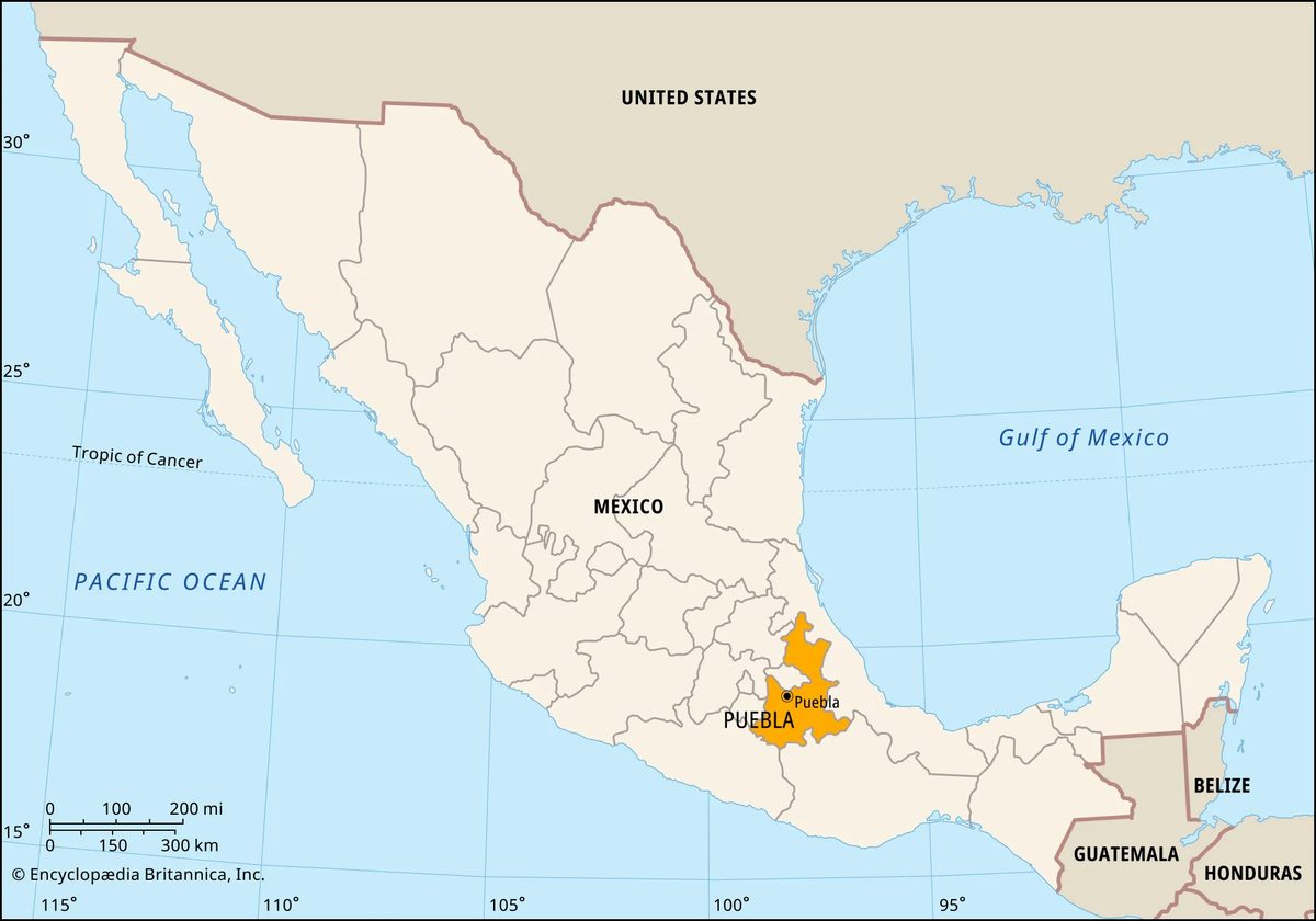

Puebla sits in east-central Mexico, a state defined by dramatic contrasts. It is bordered by Veracruz to the north and east, Oaxaca to the south, and Guerrero to the southwest. Morelos and México lie to the west, while Tlaxcala and Hidalgo frame the northwest corner. Nearly half the state’s population clusters in the capital city of Puebla, officially known as Puebla de Zaragoza. This urban center serves as the chief commercial hub for the region.
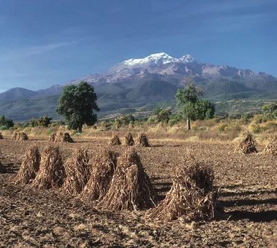
The landscape shifts abruptly depending on where you stand. In the highlands, you’ll find the Mesa Central, the Sierra Madre Oriental, and the Cordillera Neo-Volcánica. Elevations here average between 5,000 and 8,000 feet. To the east and northeast, the terrain drops into fertile slopes and river valleys that flow toward the lowlands of Oaxaca and Veracruz. The dormant volcano Iztaccíhuatl marks the border with Mexico state. Its highest peak hits 17,159 feet. The Atoyac River cuts southwest across the state, eventually becoming the Balsas River in Guerrero.
Why Puebla Matters to Travelers
The history here is rooted in rich volcanic soil and a strategic location. Náhuatl-speaking peoples built a complex civilization here, leaving behind monumental ruins that still stand today. In the early 16th century, Spanish missions arrived. Several were established on the slopes of Popocatépetl, which also touches Morelos state. These missions were collectively designated a UNESCO World Heritage site in 1994. Since the 19th century, the state has evolved into an agricultural-industrial zone within the vital Mexico City–Veracruz corridor.
For the modern traveler, this mix of history and industry creates distinct experiences. The capital city offers colonial architecture and culinary fame, while the surrounding towns provide access to high-altitude landscapes and indigenous communities.
Agriculture and Industry in the Region
Mining and agriculture employ a significant share of the workforce. Large numbers of subsistence farmers speak languages such as Náhuatl, Totonac, or Popoloc. Principal crops include coffee, sugarcane, fibers, corn (maize), and cereals. Onyx, gold, and other metals are mined in various parts of the state.
Manufacturing is also key. The chief products include processed foods, textiles, beverages, automobiles, auto parts, and machinery. Highways and railroads traverse the state, linking the capital with Atlixco, Tehuacán, and other towns. These transport links make day trips to surrounding areas feasible.
Navigating the State Government and Logistics
Puebla is divided into local governmental units called municipios. Each is headquartered in a prominent city, town, or village. The state government is headed by a governor elected to a single six-year term. Members of the unicameral legislature, the State Congress, serve three-year terms.
For planning purposes, understand that transportation networks are well-developed. Highways connect major hubs. If you are driving from Mexico City to Veracruz, Puebla sits directly in your path. This makes it a natural stopping point. The capital city itself is large and busy. It is the commercial heart of the state.
What to See and Do
The capital city, Puebla, is the primary draw. It is the state capital and a major commercial center. Beyond the city, look for the UNESCO-listed missions on Popocatépetl. They offer a glimpse into the colonial era. The highlands provide cooler temperatures and mountain views. Iztaccíhuatl is a landmark for hikers and photographers. The river valleys in the east are lush and green.
Travelers often ask about the best time to visit. The highlands can be chilly. The eastern valleys are warmer. Plan accordingly. The state’s economy relies on agriculture and industry. This

Why Puebla’s Colonial Heart Is a UNESCO Treasure
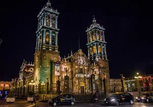
The old city isn’t just pretty. It’s protected. In 1987, the colonial centre of Puebla city secured its status as a UNESCO World Heritage site. This isn’t a casual designation. It means the architecture, the layout, and the history are locked in time for global scrutiny. For a traveler planning a trip, this is the anchor. You don’t just walk through Puebla. You walk through a preserved slice of 16th-century Spanish ambition mixed with indigenous craft.
Museums That Actually Have Stories
Most travelers skip the museums. They’re wrong. Puebla’s capital holds serious weight if you look for it.
The José Luis Bello y González Art Museum, founded in 1938, sits quietly but holds its ground. Then there’s the Museum of Santa Monica (1933). This one focuses on ecclesiastical art. Expect gold leaf, heavy silver, and saints that look like they’ve seen centuries of prayers. The Regional Museum of Puebla State (1931) rounds out the trio. These aren’t empty halls. They’re archives of a region that fought hard to define itself.
And yes, there are universities. Lots of them. This city breathes student energy alongside its old stone facades.
Nature on the Edge
You can’t talk about Puebla without looking outward. The Tehuacán-Cuicatlán Biosphere Reserve wasn’t created until 1998. It sits on the border with Oaxaca. Dry forests. Cacti. Endangered species. It’s a stark contrast to the urban sprawl.
Then there’s Pico de Orizaba National Park. It straddles the border with Veracruz. Citlaltépetl. Orizaba Peak. Mexico’s highest point. If you’re into hiking or just staring at mountains, this is the spot. It’s cold up there. The air is thin. The views are relentless.
The Voladores of Cuetzalán
North of the city, in Cuetzalán, something wild happens every October. A fair. But not just any fair. The voladores perform.
They tie their ankles to a rope. The rope winds around a tall pole. They leap off. They fly through the air as the rope unwinds. It’s terrifying. It’s beautiful. It’s ancient. You won’t see this in guidebooks that prioritize shopping districts. You see it if you go north.
The Numbers Don’t Lie
The area covers 13,090 square miles. That’s 33,902 square kilometers. Massive. Pop. (2020) 6,583,278.
Six million people. In that space. It’s dense. It’s loud. It’s alive.
How do you navigate that? You start with the UNESCO zone. Then you branch out. The museums are central. The nature parks are distant. The flyers are far north. You don’t do it all in one weekend. You pick a lane.
The colonial centre is the entry point. It’s safe. It’s iconic. It’s where the story starts. But the real story is in the biosphere reserves. In the high peaks. In the northern fairs.
Where do you go after