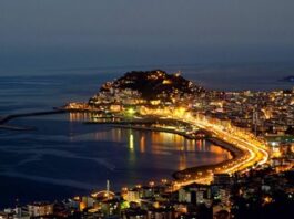
You may have heard of the lush, foggy Black Sea, but Giresun often gets lost in the chaos. The city is characterized by its greenery and attracts tourists who are looking for more than the typical coastal area. If you plan a trip here, you can enjoy the highland freshness, ancient rocks and picnic spots kept secret by the locals.
This guide cuts through the noise. We are looking for must-see castles, expansive yaylas (uplands) and a place where I can really relax without fighting for space.
Giresun overview
Although Giresun is conveniently located in the Black Sea region, it is much more than just a green dot on a map. It has special features. The area of the city is about 6,831 square kilometers, but it is not crowded. There are about 64 people per square kilometer, so there is room for maneuver.
Recent estimates put the population at around 450,000. That’s big enough for the infrastructure, but small enough that it doesn’t feel like a statistic. This low density is the key to understanding why the natural atmosphere here is so well preserved. This is not a tourist trap. This is a living, breathing landscape.
Why go? Basic requirements
Giresun’s greatest attraction is its verticality. The landscape changes dramatically from the coast to the highland meadows. Here you will find two main categories of tourist attractions: historical forts that protect the land and yaylas as summer resorts.
If you are planning a trip, focus on these factors. They define the Giresun experience.
Giresun Museum: from the background
Before heading to the hills and ramparts, some background information is needed. The Giresun Museum is a logical starting point.
This is not a huge, sprawling institution, but it provides the necessary background. In this area you will find artifacts that trace the history of different civilizations. Understanding the layers of occupation will help you understand what you’re seeing when you visit ancient ruins. It grounds the trip for the journey. Without it, you’re just looking at rocks and trees. With it to see history.
This museum provides a quick overview of the area’s past and is a quick but necessary stop before heading into Giresun’s outlying areas.
Outside the city center
The map opens when you leave the museum. The attractions are divided into different categories that determine the logistics.
- Tarihi Yerler (Historical Monuments): These are not just castles. These include centuries-old ruins and buildings.
- Yaylalar (Highlands): Giresun shines here. High altitude meadows have cool air, wildflowers and a significantly slower pace of life.
- Piknik Alanları (picnic area): The Black Sea is famous for its picnic culture. Giresun offers well-equipped attractions while maintaining its natural atmosphere.
- Plajlar (beach): Many parts of the coast are rocky, but there are good areas for swimming and sunbathing, and it is generally less crowded than in southern Turkey.
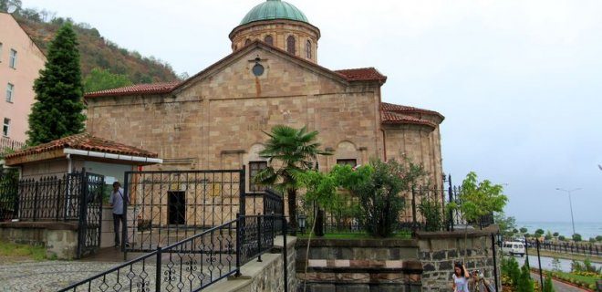
If you want to trace the historical arc of northeastern Turkey, the place the locals call Gagora is a must-see. This is the Giresun Museum. Artifacts from the Bronze Age whisper in your ears, then the heavy footsteps of Hittites, Hellenistic rulers, Romans, Byzantines and Ottomans.
It is more than just a pottery warehouse. You stand among the weapons and clothes used in real battles. This is tangible evidence of how people lived, fought and died in the area.
The story of the building itself is darker and more complicated than its current peaceful purpose. The church was originally built as the Gagora Church and remained a place of worship until 1923. Then comes the time of silence. This stone building was used as a prison between 1948 and 1967. Looking at the showcases, one can’t help but wonder who walked through these halls before the exhibits were installed. It was only in 1988 that the state officially declared it a museum, and it became what it is today.
Directions: The museum is located in Kale Mahallesi, Giresun Merkez. The zip code is 28100. It’s in the middle. If you are already in the city center, it is within walking distance.
11. Giresun Castle
When you leave the museum, the next logical step is to look up.
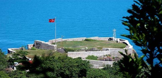
You haven’t really seen Giresunn when you stood on top of its fortress. Giresunn Castle is not just a relic; It is the crown jewel of the city. It still stands tall against time with ruins whispering stories from past centuries. If you skip it, you miss the point of the visit.
And if you want a shot—a shot of the city spreading out below you and meeting the sea—this is the only place that will deliver. The view from up here is unparalleled.
Getting There
The castle is located in the Kale district. With its central location, you’re never far from the action, but climbing is part of the experience.
* Address: Kale Mah., 28100 Merkez/Giresunn Merkez/Giresunn
10. Tirebolu Castle
Left behind for a moment is the fortress overlooking the city center. Next on the way, heading west along the Black Sea coast to Tirebolu Castle.
It’s a completely different beast. Giresunn Castle dominates the skyline, while Tirebolu Castle sits on the edge of town and guards the entrance to one of the region’s most famous towns. It’s less about the panoramic views of the city and more about the rugged, historic charm of the coastal strip.
Travelers often group this with a day trip to Tirebolu itself. Why? Because the town is famous for two things: walnuts and the castle. The ruins of the castle are located on a hill and provide a stark, beautiful contrast to the green orchards below. It’s a quieter stop. Less crowded. More atmospheric.
If you’re driving the Black Sea highway, it’s a logical detour. If you want to stay in the city center, it’s a short drive away, but the change of scenery is worth it. In less than an hour you can get from the heights of the cities to the coastal atmosphere of the countryside.
The structure itself is partially ruined, typical of the era, but the setting is pristine. You can wander the remaining walls, look out at the forested hills and imagine the trade routes that once passed here. It is not as magnificent as the major citadels of Anatolia, but it has a quiet dignity.
Pack a snack. The view from Tirebolu is best enjoyed with a walnut in hand. Literally. The region produces some of the best in the country. Eating them while standing on ancient stones feels appropriately thematic.
11. Giresunn Island (Adası)
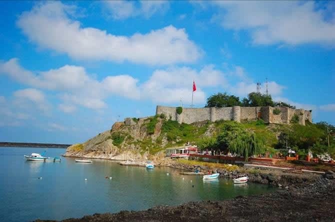
If you’ve ever wandered the coastal town of Giresun, you might have seen the outline of Tirebolu Castle, perched precariously on a cliff jutting out from the sea. It’s a place that invites visitors to step out of their cars, ride the breeze and fall in love with its bold location. Thousands of people come to see it every year, and for good reason. This is the most famous landmark in the region and a clear reminder of the strategic importance of the Black Sea coast.
Go to the fortress
The castle is not hidden on a remote mountain road. It’s there, within reach and majestic. You can find it in Cintaşı Mahallesi along Amiral Şükrü Okan Caddesi. The exact address is No:68 in the 28500 postal district of Tirebolu. It is located on the edge of a cliff with a direct view of the water. It is definitely one of the most photographed places in Giresun because the contrast between the ancient rocks and the roaring sea is so stark.
9. Giresun Adası
But the story does not end at the castle walls. Giresun Island is located rising from the dark waters of the Black Sea. It is the only major island in the entire Turkish Black Sea region, making it a unique destination for travelers looking for something other than the typical coastal hike.
The island is only about 2.5 kilometers from the port of Tirebolu. You don’t need a submarine to get there. During the tourist season, there are regular ferries between the mainland and the island. The trip itself is short, usually 10-15 minutes, but it makes you feel like you left the world behind. When you cross the ocean, the scenery on the mainland changes and the island itself becomes clearer.
Why go there? This is not just a matter of novelty. The history of the island predates the establishment of the castle. Ancient sources claim that this was the sanctuary of Artemis, and ruins of ancient churches and monasteries still remain in the area. The vegetation here is also different. It’s denser and wilder. Hike winding paths through pine forests and steep cliffs.
The logistics are simple. Ferries usually depart from Tirebolu pier, but the frequency can vary depending on the weather and the time of year. In the peak summer months, they run frequently. During off-season you may have to wait longer or check with local operators. It is wise to arrive early. The boat fills up quickly and the best seats on the ferry deck are reserved for first arrivals.
What is really worth seeing on this island? The ruins are the biggest attraction, but the most impressive thing is the tranquillity. There are no big cities or noisy resorts here. The only sounds you hear are the waves, the wind blowing through the trees and the occasional dog bark. Here you can easily spend half a day. Walk the circle. Find a place to eat lunch and enjoy the views that no castle wall can match.
Perfect for visiting Tirebolu itself. You can visit the castle in the morning and take the ferry to the island in the afternoon. Still, there’s still time to head back into town and explore the local walnut cake and hazelnut shops. Enjoy a fulfilling but not tiring day trip
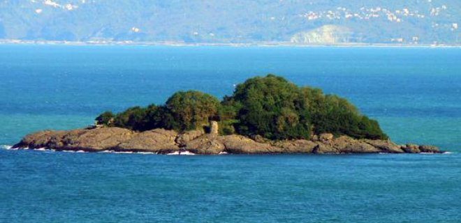
Although Giresun is located in the Black Sea region, it is overlooked by most tourists, mainly because it is overshadowed by bigger names. But it’s home to one of the area’s two significant islands in the area, and the main island (Giresun Adası for short) is a kind of time capsule. In summer, the water is full. In the off-season, it’s just you and the centuries-old stone.
The island is anchored by a fortress rising from the shore. You can get there from the mainland by boat. The journey is short, but the rewards are huge with historical weight. What you find when you arrive is not a pristine resort. You’re looking at fragments. Walls. Tower bases. The song echoed over the crumbling silhouette of the former monastery.
Getting there requires planning. You need to take a boat from Giresun port. The schedule may change depending on the weather. Boats run more often during peak summer months. In spring or fall, you may have to wait for hours or there are fewer options. Check locally. Don’t rely on app predictions. The maritime rhythm here is older than digital timers.
Why Giresun is a unique Byzantine ruin
The ruins tell a story of siege and survival. The walls of the fortress are still standing, defying erosion and time. The tower rises from the rocky terrain and offers views of the Black Sea. This is not a theme park. It’s an archaeological site in a natural setting. The monasteries are less intact, often just foundations and scattered stones, but their presence marks the island’s spiritual history of the island.
You walk these paths with a sense of isolation. There are no ticket booths. No guided tours unless you arrange them privately. This is for travelers who don’t mind getting lost and prefer silence over commentary.
Access to fortresses and coastal ruins
The only way to get there is by boat from Giresun town. Private boats are also available, but private ferries operate on fixed routes. Costs vary by season and operator. Expect to pay a modest fare for the crossing. Bargaining isn’t common on scheduled boats.
Once the path to the fort is ashore, it is well marked but steep. Wear sturdy shoes. The terrain is rocky and steep in places. Although the wall itself is accessible, certain areas are off-limits for safety reasons. The towers offer panoramic views, especially at sunset. The light turns the stone gold, then red, then gray.
Comparing Giresun Adası to Other Black Sea Islands
Unlike the more developed and touristic Marmara Island, Giresun Adası remains raw. There are no luxury hotels. There are no crowded beaches. Only history and nature. If you’re looking for comfort, look elsewhere. If you are looking for solitude and a tangible connection to Byzantine times, this is the right place.
The monasteries on the island are scattered. Some are close to the coast, while others are inland. Hiking between them takes time. The trails are not well-maintained. Use a map. Stay on the marked paths so you don’t get lost in the dense vegetation.
What to Bring and What to Expect
Bring water. There are no vendors on the island. Bring a hat. The sun reflects off the stone and water. Bring a camera, However, don’t expect to take perfect pictures. The ruins are
7. Giresun Plajları
If you’ve been climbing rocks or staring at rock forts for days, you need to reset. Giresun coastline offers that reset in spades. The Black Sea here doesn’t have the turquoise clarity as the Mediterranean, but it has a rugged, moody beauty that feels more honest.
The beaches aren’t just strips of sand; they are gateways to the quiet part of the area.
Where to go:
* Tirebolu Beach: Right near the castle. Some areas are pebbly and others are sandy. Perfect for a quick swim after exploring the castle above.
* Sülünova Beach: Located a little to the south. There are fewer people. More natural.
* Giresun Central Beach: Located in the center of the city. Convenient but busy.
When to go:
Summer (June-September) is warm and suitable for swimming. May and October are good months for walking instead of swimming. The water is very cold. Always.
Logistics:
There is a shortage of parking spaces in Tirebolu during the busy season. Arrive early. Or walk. The road along the coast is very scenic.
What to expect:
The sea is rough. Waves crash hard. This is not a laid-back beach. This is a power beach.
Price:
Admission is usually free. Umbrellas and chairs are available for an additional fee. If you want to save money, bring your own.
**Why go? **
View of Giresun from the water. The mountains drop straight into the sea. It’s dramatic. It’s real.
How to get there:
The bus journey from the center of Giresun to Tirebolu takes about 45 minutes. Regular service. cheap.
Which beach is the best?
It depends on what you want. Is it quiet? Sülünova. Accessible? Central. Beautiful scenery? Tirebolu.
Is it worth it?
Yes. If you are tired of history, go to sea. It cleanses the soul.
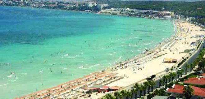
Summer in Giresun is not all about mountains. It is about the water, too. If you are planning a trip in the hottest months, you want to experience the cool atmosphere of the Black Sea for the Black Sea’s cool embrace.
The shoreline provides reprieve from the humidity. It is not as warm as the Mediterranean, but you can relax in the refreshing clear waters. It’s a different kind of relaxation. Spend less time in the sun and more time letting the current wash away the fatigue of travel.
The most popular attractions are well maintained and easy to find. Belediye Plajı and Jandarma Plajı top the list for locals and visitors alike. They’re central. Accessible. Perfect for a quick dip or a full afternoon.
But the coast is much more than that. The coast of Giresun is full of small, quiet places. Arif Kumaş Plajı offers a slightly more relaxed atmosphere. Giresun Plajı is located in the city center and is perfect if you don’t want to go far from your hotel. Tabya Plajı and Emniyet Plajı are also permanent favourites.
Further towards the city of Tirebolu you will find tirebolu Plajı. It’s worth driving if you want a change of scenery. The water outside feels different than usual. The air becomes sharper.
Then there are the mountains.
Sis Dağı Yaylası
Let’s leave the sea behind. Head inland. Ascend.
Sis Dağı Yaylası or Sis Dağı Plateau is not a beach destination. This is a world away from the coast. This is where the weather turns. This is where the “fog mountain” lives up to its name.
You can’t swim here. You will find silence. There is also fog. There are also views that spread into the gray.
This is a high plateau. The air is thin. The pine forests are dense. In the summer, it becomes a refuge for those tired of the coastal heat. Even cooler. Significantly cooler.
Getting there requires a plan. The road is winding. they climb. If you’re driving, take your time. The scenery changes every kilometer. Dense coastal vegetation gradually gives way to open grasslands, then to rocky outcrops, and finally to the plain itself.
Timing is important here. You can go in summer, yes. But the real magic happens when the weather changes. Summer storms arrive quickly and blanketing the plateau in thick fog. It’s disorienting. It’s beautiful. That’s exactly why people come here.
If you are looking for a place to hike, this is the place. The trails are not paved. They are dirt roads that pass through meadows and forests. cladding. When the sun goes down, the temperature drops quickly. Even in July the nights can be cold.
Is it worth deviating from the coast? Only if you want both. The Black Sea and the Black Mountains. One is liquid. One is solid. Both are part of Giresun.
Most travelers choose just one. Beachgoers stay close to the water. The hikers head up. Few do both in
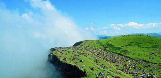
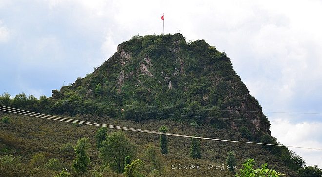
Passing through Giresun’s most famous mountain, you will lead directly to Sis Dağı (Mount Sis), the main feature of the area’s landscape. Although the view from the top is often said to be breathtaking, it is also important to distinguish between the mountain itself and the fortress of the same name. The famous Giresun Castle is actually located on top of a different mountain, but the panoramic experience is similar and makes you feel like you are walking on clouds.
Head to the top of Sis Dağı
Sis Dağı is located in Görele district in Giresun. It is one of the highest mountains in the region and has challenging terrain for those who attempt to climb it. The summit plateau is a popular destination, especially in summer.
Why do tourists flock here in June and July? This is due to the annual festivals held on the plateau. These events transform the highland landscape into a hub for local culture, food and community gatherings. Timing is everything, especially if you’re planning a trip to a party.
Access Point : The most practical way to access Sis Dağı’s base is via Görele’s Yesildere Village. From there you can arrange local transportation or start climbing depending on your foot fitness level and current trail conditions.
5. Gölyanı Jairus
After leaving the steep slopes of Sis Dağı, the next destination on the list is Gölyanı Yaylası. Unlike the lively festival atmosphere of the neighboring countries, this plateau offers a different kind of peace.
Gölyanı is located in the Bulancak region, so it is more accessible for day hikers than the remote highlands. The area is named after a charming little lake surrounded by green meadows. This is an ideal location.
- Peaceful picnic : The areas are usually a bit smaller than at the Sis Dağı festival.
- Viewing wildflowers : From late spring to early summer, the slopes are covered with native flowers.
- Hiking : Short, manageable trails wind through the pine forests surrounding the plateau.
Sis Dağı attracts many tourists with its activities, while Gölyanı attracts those looking for a quiet connection with nature. It takes about 1 hour by car from the center of Giresun, depending on the traffic. Park your car near the center of the village and walk to the lake where the surrounding mountains are reflected in the water.
It is worth noting that Gölyanı’s service is basic. Please bring water and snacks, as there are limited vendors on site. The charm of this place lies not in its luxurious amenities but in its pristine natural scenery.
Travelers looking to make the most of their time in Giresun can combine a visit to Gölyanı with a visit to Sis Dağıg for a well-rounded experience. One offers cultural immersion and high-altitude views. The other offers views of the highlands while immersing yourself in the culture. The other is a peaceful beach sanctuary. Both are must-sees for anyone who wants to understand the geographic diversity of the Black Sea region.
The roads to these highlands can be narrow and winding. Drive carefully, especially when there is fog, which is common in the region.
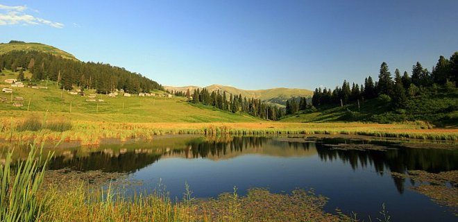
The air here is not only cool. It feels like it wipes you clean.
Goryanu Plateau is on almost every Black Sea traveler’s bucket list, and for good reason. The summer heat will soon subside, but there’s more to it than just climbing the heights to escape the summer heat. This is the landscape itself. As soon as I got out of the car, I saw a dark small lake surrounded by dark green meadow in the middle of the plateau. The landscapes are vast, the silence heavy and the atmosphere is designed to slow down the pulse.
Getting there requires some effort or at least a certain route. If you drive a car, navigation must be accurate. You will visit the village of Derindere, which is part of Yağlıdere district in Giresun province. The road winds through dense forests and steep cliffs. This is not driving on the highway. This is a driving route that requires concentration, with waterfalls and rocky outcrops along the way. When we finally arrive, it’s a short but steep climb from the village to the plateau itself.
Why Gölyanı stands out in Giresun
Most highland sites in Turkey have grazing animals and simple wooden houses. Goryanu is unique because of its central water feature. The lake is not very big, but that anchors the entire experience. It takes about 20 minutes to walk. The water is often calm and perfectly reflects the surrounding pine forest, making it difficult to tell where the sky ends and where the land is.
Logistically, this is a day trip destination for most people, but it is also possible to stay overnight in a nearby village. The weather is unpredictable. If you fry it in the heat of the Giresun heat, it will cook quickly. Then the clouds roll in, the temperature drops 10 degrees and a thin layer of fog clings to the trees. cladding. every time.
The drive from Yağlıdere town center to Derindere takes about 40 minutes along winding mountain roads. If you’re using public transport, you’ll need to take a dolmus (shared minibus) from Yağlıdere to Derindere and then either negotiate a local route or hike the last stretch to the plateau. Taxis are available in Derindere but are expensive and unreliable. Plan to arrive before mid-afternoon if you want to capture the best light for photos. In the morning the sun shines on the eastern slopes, and in the evening the plateau remains in shadow.
Kümbet Plateau: Next destination
Just when you think you’ve seen enough of the Highlands, you reach the next landmark.
4. Kumbet Jairus
Kümbet Yaylası is more than just a name. It’s a description. The word means “dome” and refers to the unique dome-shaped rock formations and historic structures that dot the landscape. Unlike Gölyanı’s open, lake-centric landscape, Kümbet feels more ancient and rugged.
This plateau lies a short distance on the same general axis as the Giresun highlands, and is usually reached by a similar route via Yağlıdere. It is less developed than some southern regions. There are fewer tourist traps here.
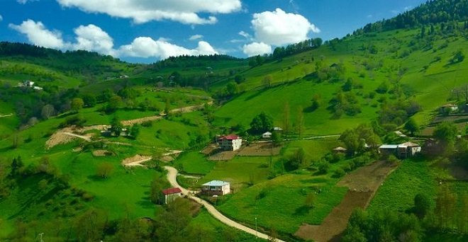
Tell me the truth. If you’re traveling to Giresun for more than just tasting the famous hazelnuts, you’re probably looking for high altitude. The high plateaus (yaylalar ) is more than just a tourist option. They are the main event. They define the landscape, the climate and why people escape the heat of the coast.
Among the green carpets floating in the sky, Kümbet Yaylası has a special place. It’s more than just a dot on a map. It is a vast land full of greenery that feels untouched by time. While some of the plains are rugged and difficult to navigate, Kümbet offers an easy way to experience life at high altitude. This is the place to bring your family. You bring these views because they are so stunning that they almost feel artificial, yet completely real.
Arrival at Kümbet Yairas
Getting there requires some effort, but the journey is part of the reward. The access point passes through Kümbet Village, which acts as a gateway. From the main road, you have to go through the Dereli area and climb the last climb to Giresun province. The roads are winding and the mountainous terrain is typical of the Black Sea region. This trek not only tests your patience but also offers panoramic views of the valley below as you climb.
“Kümbet Yaylası is more than just an object, it’s a change of perspective.”
When you arrive, you will be shocked by the vastness of the plateau. It is extensive. You can spend hours walking, searching the meadows and watching the clouds roll over the distant mountains. It’s perfect for picnics, photo shoots or just doing nothing when the air gets thinner and colder.
Paşakonağı Yaylası: The next climb
If Kümbet is a gentle giant, Paşakonağı is its wild cousin. Considered to be the next big destination in the region’s tourism rankings, this plateau has other attractions.
Although Kümbet is known as an accessible and family-friendly plateau, Paşakonağı Yaylası fascinates visitors with its rustic and rugged beauty. It is less developed and more authentic. There are few amenities here, so you have to be prepared. Please bring your own food. Bring your own water. Isolation is the key.
The route to Paşakonağı usually includes narrow roads and steep hills. It is a popular place for people who want to escape the crowds that often gather at popular attractions. The silence here is profound. The air is fresh and smells of pine and damp earth.
Travelers often compare the two. Kümbet is perfect for a relaxing weekend getaway. Paşakonağı is a place for adventurers who want to escape the hassles of modern life. Both plateaus are important if you are planning a complete route around the Giresun’s highlands. The drive between these can take some time depending on road conditions and weather, so plan your itinerary flexibly.
What are you looking for in the highlands? Comfort and views? Or solitude and adventure? Your answer will determine which one you prioritize first.
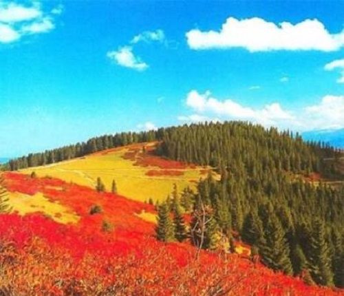
Karagöl Dağları and plateau
If you are in Paşakonağı for a short stay, Karagol is the place to go. One of Giresun’s most popular attractions, but for a completely different reason. You can actually camp here. It’s a worthwhile way to sleep under the stars, wake up to see the mist spreading over the lake and feel the cold of the Black Sea mountains.
Geography is dramatic. Karagol is located in the border area of Trabzon and is part of Karagöl-Sera National Park. The lake itself is gorgeous, dark and deep, surrounded by lush forests. But the real attraction is the plateau above it. In summer, the meadow turns into a sea of wildflowers. The air is fresh. Silence is heavy.
How to get to Karagöl Dağları
It takes effort to get there, which is why there are less people there than in southern Turkey.
By car:
The standard route starts from the center of Giresun. Go to Bulancak and take the road to Şebinkarahisar. The last part is a steep dirt road. It is not paved. It is not wide. A vehicle with good clearance is required. An SUV is safer, but watch the rocks and drive slowly, a durable sedan is fine. The drive from Giresun takes about 3-4 hours, depending on road conditions and weather.
If you use public transport:
There is no direct bus to the lake. Take the bus to Şebinkarahisar. From there you need to arrange a local taxi or a shared jeep. These flights depart in the morning and return in the late afternoon. The schedule is very tight. If you miss the return, you’ll be stuck. Please plan accordingly.
Where to stay and what to bring
Unlike Paşakonağıg, Karagöl has basic camping facilities. There are some cabins by the lake, but they are very simple. There is no electricity. There is no hot water. Bring your own sleeping bag. The ground is uneven. Let’s say you pitch your tent on grass or dirt.
If you don’t want to camp, the nearest town, Şebinkarahisar, is a good option. It has hotels, but it is far from the lake. Half of your journey is spent in transit. Most of the travelers go camping. This is the only way to fully experience the plateau.
Why Karagol is worth a detour
- Lake: The water is very cold. It is clear. On a calm day, the reflections of the mountains are perfect.
- Hiking: The trail leads to another smaller lake, Lake Sera. The hike takes about 2 hours. The elevation gain is steep. The scenery is worth the sweat.
- The Flora: Flowers bloom on the plateau in July and August. Wild tulips, irises and poppies cover the slopes. It’s a photographer’s dream.
- The Silence: No traffic noise. There is no cell service. Just the wind and the birds.
Practical tips for visitors
- Weather: Change instantly. Sunny at noon can turn to rain by 2 PM. Bring layers. Rain gear is required.
- Supplies: There is no shop there
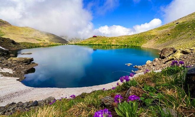
You never saw Giresun until you climbed up there. Skip coastal traffic and hazelnut orchards. Go to the Karagol Mountains where the air is thin. These mountains are not only high, but they are also the backbone of some of the most spectacular summer meadows in the region. If you’re planning a trip, you should know that this area is a maze of Oba, traditional shepherd villages located on the hillsides. they are very quiet. They are rugged. They are the real destination.
The crown jewel is Mount Karagol itself, which reaches a height of 3,107 meters. But it’s not just about reaching the top. Aim for that shade. Aygır Gölü is located at the foot of the mountain in the Alpine Basin. This view is deceptive. It looks like a painting until you stand on the rocky shore and watch the mist rise from the water. Please take a look before you go. Really see it. Because when people see something like this, the rest of the world becomes less sharp.
Trekking to Kuzalan and Mavigöl
The journey becomes more interesting as you head towards the west side of the mountain. Here, the landscape changes from open meadows to dense forests and waterfalls. Two names often appear in local guides: Kuzalan Şelalesi and Mavigöl.
Kuzalan Falls is not a tourist trap. This is a walking tour. It is located deep in the forest and is reached by a winding path through beeches and spruces. The water just doesn’t fall. It roared over the moss-covered rocks and disappeared into the cold enough to steal your breath pool. It is a peaceful place.
The nearby Mavigöl (Blue Lake) lives up to its name. The water is a piercing, unnatural blue in color, probably due to its mineral content and depth. It is smaller than Aygır Gölü, but has a more intimate atmosphere. The air is fresh and you can swim here in July and August. There are steep slopes around the lake, so it feels remote, even if you’re not the only one there.
“If you’re looking for an exciting yet peaceful day hike, look no further than the Kuzalan Waterfall trail.”
Logistics: How to Reach the High Plateaus
To get here, you have to change your mindset. Buses from Giresun city centre will take you to a hilly area, but you’ll need to take a local minibus (dolmuş) or hire a driver to navigate dirt roads. The road is very narrow. Night lighting is very poor. Please drive slowly.
The best time to visit is from June to September. Before June, snow melted and roads were muddy. From September, shepherds bring their flocks down and roads are closed for the winter. If you visit in July, expect warm days and cold nights. Pack layers. Always.
What to include and what to leave out
Don’t bring expensive city sneakers. You need hiking boots that are durable and have good grip. The terrain is rough and rugged. Bring a headlamp. There is no mobile phone service in the upper Oba area
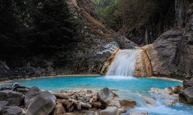
Places that have not yet been branded with mass tourism are often overlooked. Mavi Göl, known locally as Kuzulan Şelalesi, fits into this category. Today, it’s a secret kept by locals and occasional hikers. But if you’re looking for a destination that doesn’t feel like a theme park, this is it.
The water is very blue and looks synthetic. That’s the first thing that surprises you. Another is silence. Or rather, water washing over rocks in a valley miles from the nearest town.
Many travelers miss this place because it is not on the main tourist routes. But for those who find it, it will become a permanent bookmark in their travel memories. It’s the kind of place that makes you want to stay longer than you planned. You’ll end up taking hundreds of photos. Try to catch the shadow in the water. Then put the camera down and sit there.
How to get to Kuzulan Şelalesi
It takes a bit of effort to get here, but that’s part of the charm. This is not a drive-through attraction. These coordinates lead to Dereli district in Giresun, specifically Pınarlar Village.
This route goes along the Giresun – Shebinkarahisar road. If you use a navigation app, search for the address: 28950 Pınarlar Köyü/Dereli/Giresun.
You need a vehicle that can drive on roads. You can drive the main part with a normal car, but the last part to the waterfall and the lake requires careful driving. The roads can be narrow. It can be crooked. The sidewalk is not always in perfect condition. But the scenery along the way – green hills, scattered villages and changing lights – make the drive part of the experience.
Why visit Mavi Göl now?
Opportunities to visit such places will be restricted until the situation changes. Kuzulan Şelalesi is currently in this sweet spot. It’s not crowded. You can find a quiet place by the water without having to fight for space. With little infrastructure, its natural beauty remains intact.
Imagine yourself standing on the edge. The water is dark blue. The contrast with the surrounding green forest is striking. The air is cool. The sounds of the city disappear. You are just you, the water, and the trees.
This is not a place where you just take a photo and leave. This is a place you won’t want to leave. Breathe. Realize how small you are in the grand scheme of things.
What to expect
This lake is formed by a waterfall, hence its double name. The water flows continuously, creating a natural pool. The water temperature is cold even in summer. If you plan to swim, be prepared. It’s refreshing, but not for the faint of heart.
Photographers can find endless angles here. The light changes throughout the day. The morning light is soft and diffuse. The afternoon light creates a vivid contrast. Sunsets are dramatic and can paint the water in shades of gold and blue.
There are no shops